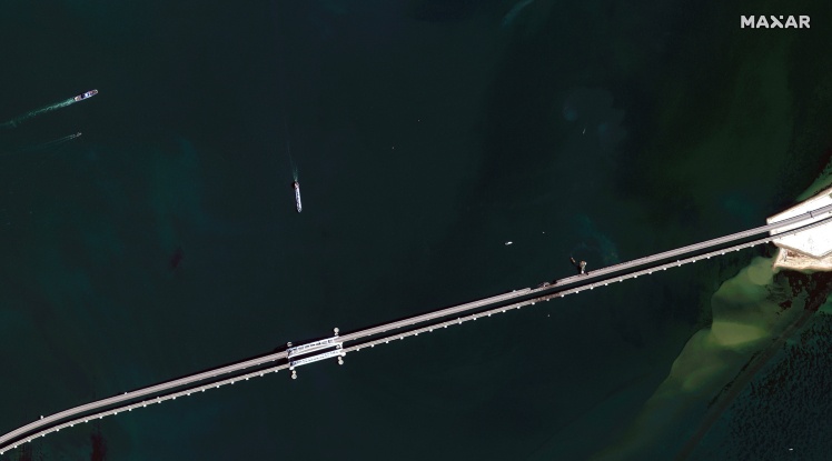
The Maxar service has published new satellite images of the Kerch Bridge.
The pictures taken on October 12 show how the repair of the bridgeʼs railway track and the damaged sections of the road bridge span are in progress. They also show vehicles driving along the bridge, and nearby is a ferry that transports trucks.
On the morning of October 8, an explosion occurred on the Kerch Bridge, which connects Russia with the occupied Crimea, as a result of which two spans of the roadway collapsed. Traffic on the bridge was blocked, and Putin instructed to create a government commission in connection with the emergency.
On October 12, the Federal Security Service of Russia announced that the organizer of the explosion on the Kerch Bridge was the head of the Main Intelligence Directorate of the Ministry of Defense of Ukraine Kyrylo Budanov. The explosive device was allegedly camouflaged in rolls of construction polyethylene film on 22 pallets and "sent from the Odesa seaport to the Bulgarian city of Ruse" at the beginning of August. From there he went to Georgia, and then to Russia.
